 (Image via
When winter arrives, the northern reaches of Canada reveal a world of ice, snow, and unforgettable journeys on remote roads. Traveling here introduces you to a breathtaking landscape of sweeping wilderness, dramatic snow-capped mountains, and tranquil evenings magically lit by the aurora borealis. Setting out during this unique season is a truly memorable experience that promises both adventure and solitude. This comprehensive guide is designed to help you organize a seamless and safe trip from start to finish. Inside, you'll find essential highlights, crucial safety advice for navigating icy conditions, and recommended stops for the best views and local culture. Get inspired to discover the frosty wilds of this vast and beautiful region. Let’s begin planning your adventure across its remarkable wintry expanses.
Planning Your Northern Canadian Winter Drive
A journey along these frosty routes takes more planning than a typical summer drive. The payoff, though, is huge; fewer travelers are out on the roads, and the frozen scenery is truly breathtaking.
Vehicle Preparation is Key
Your vehicle is your best friend when traveling far from towns in these harsh conditions. Before starting out, double-check it’s prepared for freezing temperatures and unpaved stretches.
- Winter Tires: This is non-negotiable. Winter tires provide essential grip on ice and snow. Look for tires with the three-peak mountain snowflake symbol.
- Engine Block Heater: In extreme cold, engine oil can thicken, making it difficult to start your car. An engine block heater keeps the engine warm overnight. Most parking lots in northern communities have plug-ins.
- Survival Kit: Pack a comprehensive emergency kit. Include extra blankets, warm clothing, non-perishable food, water, a first-aid kit, a shovel, traction mats, jumper cables, and a tow rope.
- Fuel: Gas stations can be hundreds of kilometers apart. Never let your tank drop below half-full. Carry an extra jerry can of fuel for emergencies, but be sure to store and transport it safely.
Understanding the Risks
Traveling northern roads in winter brings its own set of challenges. Temporary closures may happen due to severe weather or avalanches. The days are much shorter, and reliable mobile coverage is rare outside main communities. Always consult official territorial or provincial sites like 511 Yukon or 511 Alberta for up-to-date conditions before heading out. For added peace of mind, carrying a satellite messenger, such as a Garmin inReach or SPOT, can be a valuable backup if emergencies arise.
Here are three outstanding winter road adventures that highlight the unique wonders of Canada’s far north.
1. The Dempster Highway: Journey to the Arctic Ocean
The Dempster Highway is an iconic remote route in Canada’s north. This 740-kilometer (460-mile) gravel stretch begins at the Klondike Highway in Yukon and travels all the way to Inuvik in the Northwest Territories. During the colder months, an ice road stretches another 194 kilometers (120 miles), linking travelers to the small coastal community of Tuktoyaktuk on the edge of the Arctic Ocean.
The Route at a Glance
- Start: Dawson City, Yukon
- End: Tuktoyaktuk, Northwest Territories
- Distance: Approximately 934 km (580 miles)
- Recommended Time: 4-5 days one way
Highlights and Stops
Your adventure starts in Dawson City, a lively relic of the gold rush era. From this starting point, the roadway stretches across a sweeping, open landscape. You’ll pass through Tombstone Territorial Park, an area renowned for its dramatic black granite peaks and pristine wilderness. The route offers a sense of solitude and a front-row seat to some of the region’s most stunning vistas.
Eagle Plains stands out as the only place to find services along the Yukon stretch of this journey, located at the 369-kilometer point. It's an essential rest stop where you can fuel up, grab a meal, and enjoy a break. Not far beyond, you'll cross the Arctic Circle, which is a latitude marked by a modest sign that makes a memorable spot for photos.
Arriving in Inuvik, your journey continues along the Inuvik-Tuktoyaktuk Highway, an all-season route built on permafrost. Completing this last stretch to the coast is a remarkable experience. At Tuktoyaktuk, you can touch the frigid ocean waters or at least stand at the icy shoreline and learn about the local Inuvialuit way of life.
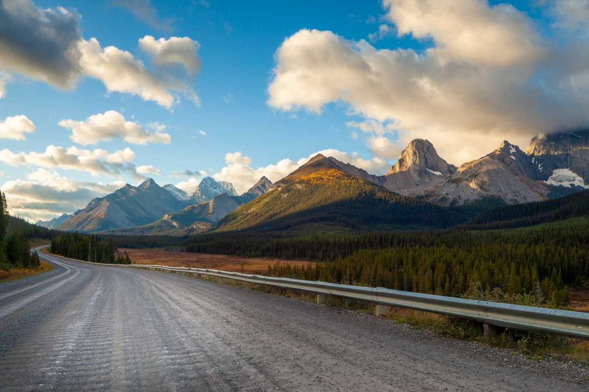
2. The Icefields Parkway: A Drive Through Glacial Majesty
Covering 232 kilometers (144 miles) across the dramatic heart of the Rockies, Highway 93 links Banff and Jasper National Parks in Alberta. While this route is celebrated for its summer scenery, winter transforms it into a tranquil wonder. Snow blankets the peaks, and the landscape takes on an even more breathtaking, peaceful quality.
The Route at a Glance
- Start: Lake Louise, Alberta
- End: Jasper, Alberta
- Distance: 232 km (144 miles)
- Recommended Time: 1-2 days
Highlights and Stops
Before you even set out on this breathtaking route, the frozen expanse of Lake Louise greets you. Its famous chateau standing elegantly below the Victoria Glacier. Heading north, each bend reveals new panoramas of snowy summits and icy waterfalls, painting a picture of true winter wonder.
You’ll want to make stops at Bow Lake and Peyto Lake, although the main Peyto Lake lookout is often closed during colder months. At the Columbia Icefield, the Athabasca Glacier is a highlight. Take a short walk to get a close-up view of this impressive river of ancient ice.
Heading north, you’ll find Sunwapta Falls and Athabasca Falls transformed by winter, with intricate ice shapes clinging to the rocky cliffs. The journey comes to a close in the welcoming community of Jasper. Here, you can go ice skating on Mildred Lake or join a professional guide for an icewalk in Maligne Canyon. This area is also part of a Dark Sky Preserve, offering outstanding opportunities for stargazing and watching for the aurora.
3. The Alaska Highway: A Historic Winter Trek
Constructed during World War II, this iconic highway remains one of the most storied routes in the North. Tackling it in winter calls for careful planning and resilience, yet the payoff is extraordinary views and a rewarding sense of achievement. Most travelers follow the Canadian stretch from Dawson Creek in British Columbia to the border with Yukon and Alaska.
The Route at a Glance
- Start: Dawson Creek, British Columbia
- End: Whitehorse, Yukon (or continue to Alaska)
- Distance to Whitehorse: Approximately 1,422 km (884 miles)
- Recommended Time: 5-7 days
Highlights and Stops
Begin your trip at Dawson Creek’s historic Mile "0" marker. The route leads you into the northern Rockies, treating you to remarkable mountain vistas along the way. A don’t-miss stop is Liard River Hot Springs Provincial Park. Taking a dip in these naturally heated pools surrounded by snowy forest is a peaceful and unforgettable highlight.
Watson Lake, Yukon, features the quirky Sign Post Forest, where more than 90,000 signs from travelers all over the world create a fascinating display. In winter, the signs take on a frosty charm, making the site look especially magical beneath a layer of ice and snow.
The road leads on to Whitehorse, Yukon’s lively capital and a fantastic jumping-off point for adventures nearby. While in the city, consider visiting the Yukon Wildlife Preserve, where you can spot animals like wood bison and arctic foxes, or embark on a dogsledding excursion. Whitehorse offers access to even more northern sights, or you can head further along the legendary highway all the way into Alaska.
Venturing out on a wintertime drive across northern Canada is an invitation to embrace adventure in its rawest form. Blanketed in quiet snow, the scenery inspires awe and a sense of calm seldom found elsewhere. By preparing thoughtfully and nurturing your sense of curiosity, you’ll be ready to enjoy everything this region has to offer. Gather your coziest layers, make sure your ride is set for the journey, and embark on an experience that will leave you with stories and memories to cherish from Canada’s wondrous frozen roads.